American Meteorologists Lag Behind Europeans Predicting Storm Paths; Even the Air Force Relies on British Weather Models
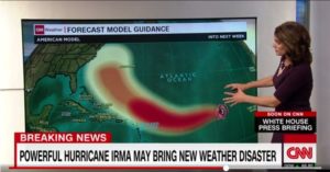
Our country’s best weather forecasters missed the path that Hurricane Irma would take by an average of about 194 nautical miles in their five-day forecasts, a difference more than twice as big as their European counterparts.

Discrepancies such as these lulled residents of Miami, which the hurricane was later predicted to hit, to seek safety in Tampa close to where Irma actually did make landfall. Many Tampa-area homeowners and renters stayed put.

“The United States needs a ‘moon shot’ program to dramatically improve weather prediction,” said Ryan Maue, a meteorologist and critic of U.S. weather forecasts.
Our country’s forecasters, who use computer modeling, satellites, weather balloons and flights into the eye of hurricanes, have gotten better.
The average error from 2011 to 2015 for five-day forecasts of the path of hurricanes from the National Hurricane Center was 222 nautical miles, said Ryan Torn, an associate professor at the State University of New York at Albany who works with the center.
But Europeans are getting better faster.
Action Box/What You Can Do About It
Call the White House at 202-456-1414 to give your opinion about staffing at NOAA and funding for weather forecasts.
Contact your senators and representative.
The Environmental Defense Fund, which has raised questions about proposed NOAA cuts, can be reached at 800-684-3322.
Cliff Mass, a professor of atmospheric sciences at the University of Washington, said in 2016 that U.S. global weather predicting was in fourth place, behind European, British and Canadian forecasters. The U.S. Air Force uses British weather-modeling software.
Safe and Sound
DCReport.org volunteer proofreader Maureen Gibbons rode out Irma at her home north of Orlando. She reports: “Power out for only 16 hours. Very safe and blessed. Spent the night in the bathroom with two screaming, warring cats.”
The best-known miss by the Global Forecast System is Hurricane Sandy in 2012 which the European model had making landfall somewhere between New Jersey and New York City while forecasters from our country initially had it staying safely out to sea.
Things could get worse under Trump. His budget calls for cutting the National Oceanic and Atmospheric Administration by 16%. The National Weather Service is already understaffed, and the weather service put out alerts in all caps for almost 170 years because the system was designed for the telegraph.
Brian Tang, an assistant professor at the State University of New York in Albany, called the Irma predictions by the European Centre for Medium-Range Weather Forecasting, or ECMWF, exceptional.
“I wouldn’t expect the [European Centre] to perform this well for all other hurricanes,” Tang said. “For example, the mean absolute errors for Hurricane Jose are about 215 nautical miles for both” the U.S. and European models.
Jose is now a Category 2 hurricane north of the Leeward Islands. About one-fourth of the U.S. system tracks run Monday showed it hitting the United States. The European model predicted Jose would remain at sea or make landfall in New England or Canada.
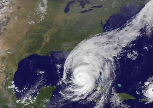
Featured Photo: A Sept. 10 NASA image of Hurricane Irma as it rolled up the Florida peninsula.


